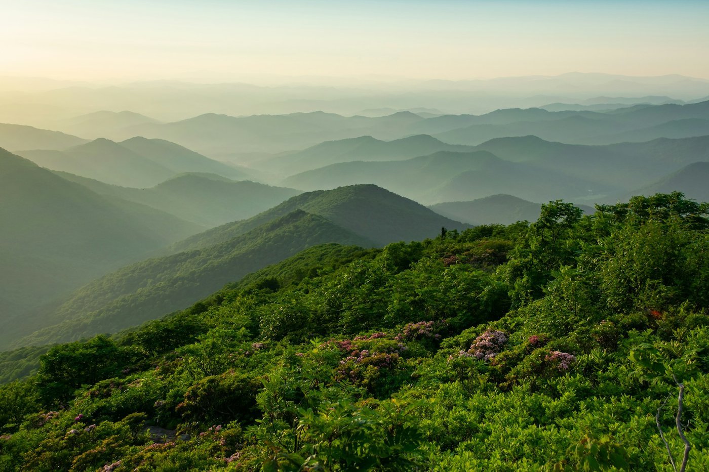
The best hikes in Georgia span granite domes, waterfall gorges, a canyon carved by 1800s farming erosion, and a barrier island where wild horses outnumber cars — and the 15 trails below cover all of it, from a 25-minute drive out of Atlanta to a full-day trip to the coast. Every fee, permit, distance, and dog rule here is checked against the U.S. Forest Service, Georgia State Parks, the National Park Service, or the operating agency’s own site, current as of September 2026.
Georgia’s state parks raised their parking fee on January 1, 2026, from the long-standing $5 to a $10-per-vehicle daily ParkPass (or $70 annually), so if you’ve hiked here before, expect a higher number at the gate. National forest trailheads charge their own separate day-use fees, usually $4 to $5 per vehicle, and none of them accept the state ParkPass.
Most of these best hikes in Georgia sit within a 90-minute to 2-hour drive of downtown Atlanta in the North Georgia mountains. A handful — Cumberland Island, Okefenokee, and Providence Canyon — run 3 to 5 hours and deserve a full day or an overnight. We flag drive time, dog rules, and stroller access for every trail so you can plan around your group.
| Question | Answer |
|---|---|
| What does parking cost? | Georgia State Parks charge a $10 per-vehicle daily ParkPass, or $70 annually; national forest trailheads charge their own $4-$5 day-use fee and do not accept the ParkPass. |
| How long should you budget? | Anywhere from 1 hour to a full day per trail. |
| When is the best time to go? | Weekday mornings before 10 a.m. Mid-October to early November is peak color; late April through May brings wildflowers with fewer people. |
| How far is it from Atlanta? | From 25 minutes (Sweetwater Creek, Stone Mountain) to about 5 hours (Cumberland Island, Okefenokee). |
| Are dogs allowed? | Most trails allow leashed dogs. The Tallulah Gorge Floor Trail and Hurricane Falls Loop, the Stone Mountain Walk-Up Trail and the Chesser Island Boardwalk do not. |
| Is anything stroller-friendly? | Only a handful: the 0.75-mile Chesser Island Boardwalk, Cloudland Canyon’s 1-mile Overlook Trail, the 0.3-mile West Ridge Falls Access trail at Amicalola Falls (recycled-tire surface, rated wheelchair accessible on the park map), and the first half-mile of Sweetwater Creek’s Red Trail. |
| Do you need a permit? | Only for the Tallulah Gorge Floor Trail: a free same-day permit from the Interpretive Center, capped at 100 people per day and not issued after 4 p.m. (3 p.m. during daylight saving time). |
Which Georgia hike should you pick?
| Trail | Length | Elevation Gain | Difficulty | Fee | Dogs | Drive from Atlanta |
|---|---|---|---|---|---|---|
| Blood Mountain (Byron Reece Trail) | 4.3 mi RT | ~1,400 ft | Strenuous | Free (limited lot) | Voice/physical control | About 1 hr 40 min |
| Preacher’s Rock (Woody Gap) | 1.9 mi RT | 440 ft | Moderate | Free | Voice/physical control | About 1 hr 50 min |
| Raven Cliff Falls | ~5 mi RT | Moderate-strenuous | Moderate | $5/vehicle | Voice/physical control | About 1 hr 45 min |
| Tallulah Gorge (Rim Trails and Gorge Floor) | 3 mi combined on the rim; 2.5 mi RT on the floor | Rolling with stairs on the rim; steep and rocky on the floor | Moderate on the rim; very difficult on the floor | $10 ParkPass; free permit for the gorge floor | Leashed, 6 ft on the rim; no dogs on the gorge floor | About 1 hr 50 min |
| Amicalola Falls (full loop) | 1.3 mi RT | 560 ft / 604 stairs | Strenuous | $10 ParkPass | Leashed, 6 ft | About 1 hr (Georgia State Parks) |
| Brasstown Bald Summit Trail | 1.2 mi RT | Steep, paved | Moderate | $10/adult day-use | Leashed | About 2 hrs |
| Dukes Creek Falls | 2 mi RT | Moderate | Moderate | $4/vehicle | Voice/physical control | About 1 hr 40 min |
| Panther Creek Falls | Closed (storm damage) | N/A | N/A | N/A | N/A | About 1 hr 45 min |
| Cloudland Canyon (West Rim Loop) | 5 mi RT | Rolling, some steep | Moderately strenuous | $10 ParkPass | Leashed, 6 ft | About 2 hrs 20 min |
| Sweetwater Creek (Red Trail) | 2 mi RT | Mostly flat | Easy-moderate | $10 ParkPass | Leashed, 6 ft | About 25 min |
| Stone Mountain (Cherokee Trail) | 5 mi loop | Rolling | Moderate | Per-vehicle parking fee | Leashed, 6 ft | About 25 min |
| Kennesaw Mountain (Summit Trail) | 2 mi RT | ~700 ft, most of it in the first mile | Strenuous first mile | $5/vehicle NPS pass ($40 annual) | Leashed, 6 ft | About 30 min |
| Providence Canyon (Canyon Loop) | 2.5 mi loop | Rolling | Easy-moderate | $10 ParkPass | Leashed, 6 ft | About 2 hrs 45 min |
| Cumberland Island (Dungeness Trails) | ~2-5 mi options | Flat, sandy | Easy | $15 entry + $44 ferry | Leashed, south end only | About 5 hrs |
| Okefenokee (Chesser Island Boardwalk) | 1.5 mi RT (0.75 mi each way) | Flat, boardwalk | Easy | $5/vehicle | No dogs on boardwalk | About 5 hrs |
Kennesaw Mountain National Battlefield Park, number 12 on this list, is the one trail here whose $5 fee works differently: it’s an NPS entrance pass, not a Georgia ParkPass, charged at all 10 parking lots. Details are below.
Which hikes are best in the North Georgia mountains?
1. Blood Mountain via the Byron Reece Trail
Blood Mountain is the highest point on the Appalachian Trail in Georgia, and the Byron Reece Trail from Neel Gap is the shortest way to its 4,459-foot summit — a 4.3-mile round trip with about 1,400 feet of climbing.
- Drive/Parking: About 1 hr 40 min via GA-400 and US-19/129 to Neel Gap; free trailhead lot fills by mid-morning on fall weekends.
- Stroller: No — rocky, root-covered climb the entire way.
- Dogs: Chattahoochee National Forest requires only “verbal or physical restraint,” but a leash is the safer call in the Blood Mountain Wilderness’s rocky scramble sections.
- Restrooms: At the Mountain Crossings outfitter next to the trailhead.
- Best time: Weekday mornings; this is one of the most popular AT day hikes in the state and the summit rock outcrop gets crowded by late morning on weekends.
- Tip: The final quarter-mile requires hands-on scrambling over exposed rock — leave this one off the list for very young kids.
Want to check the policy at a specific Georgia attraction? See our 303-attraction Georgia dog-policy database.
2. Preacher’s Rock from Woody Gap
Preacher’s Rock delivers a 360-degree view of the Blood Mountain range for a fraction of the effort — a 1.9-mile round trip on the Appalachian Trail with 440 feet of gain, making it one of the best short hikes in Georgia for a payoff-to-effort ratio.
- Drive/Parking: About 1 hr 50 min via GA-400 and US-19/129 to the Woody Gap Recreation Area; free gravel lot.
- Stroller: No — dirt AT tread with roots and moderate grade.
- Dogs: USFS voice/physical-control rule applies; light foot traffic compared to Blood Mountain.
- Restrooms: Vault toilet at the Woody Gap picnic area.
- Best time: Sunrise or fall foliage weekdays — the rock outcrop is small and gets tight on peak-color weekends.
- Tip: This is a good warm-up or alternative if Blood Mountain’s summit scramble is too much for your group.
3. Raven Cliff Falls
Raven Cliff Falls is unusual for Georgia: the creek splits and drops through a crack in a single rock outcrop rather than off a cliff edge, at the end of a roughly 5-mile round trip along Dodd Creek.
- Drive/Parking: About 1 hr 45 min via GA-400 and GA-75 toward Helen, then Richard B. Russell Scenic Highway; $5 per vehicle day-use fee at the Raven’s Cliff Wilderness Trailhead.
- Stroller: No — creek crossings and a rooty, moderately climbing tread.
- Dogs: USFS voice/physical-control rule; the trail follows Dodd Creek closely, so a leash helps near the water.
- Restrooms: Vault toilet at the trailhead.
- Best time: After rain for the biggest flow, spring and fall for temperature.
- Tip: Do not attempt to climb the rock crack to the upper falls — falls here have caused serious injuries; view from the marked overlook only.
4. Tallulah Gorge State Park (Rim Trails and Gorge Floor)
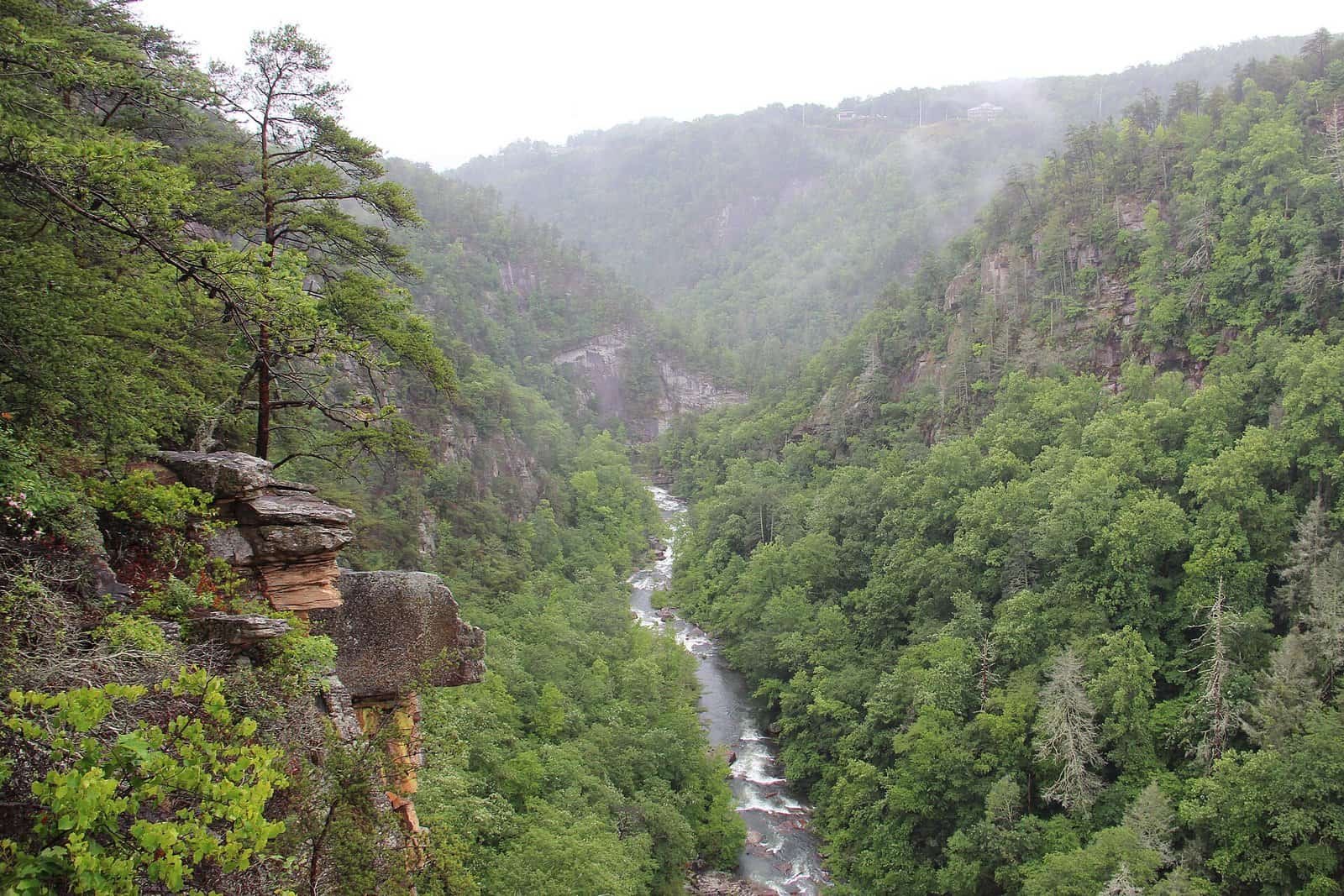
Tallulah Gorge is two miles long and nearly 1,000 feet deep, according to Georgia State Parks (750 feet at North Rim Overlook 1), and it’s really two hikes: the rim trails anyone can walk, and the gorge floor, which requires a free same-day permit and caps visitors at 100 per day.
- Distance: North and South Rim Trails combine for about 3 miles round trip with five overlooks each; the Gorge Floor Trail is 2.5 miles round trip.
- Drive/Parking: About 1 hr 50 min via I-85 N and US-441; $10 ParkPass per vehicle.
- Permit: Free gorge floor permits are issued at the Interpretive Center on a first-come basis, limited to 100 people per day and not issued after 4 p.m. (3 p.m. during daylight saving time). Closed-toe shoes are required — no sandals or Crocs.
- Stroller: Rim trails only, and even those have stairs and inclines; the gorge floor is all rock and boulder scrambling.
- Dogs: Leashed dogs (6 feet max) are fine on the rim trails, but no dogs are allowed on the Gorge Floor Trail or the Hurricane Falls Loop.
- Restrooms: At the Jane Hurt Yarn Interpretive Center.
- Tip: Arrive by 9 a.m. on weekends if you want a gorge floor permit — the daily cap is reached early during fall color season.
5. Amicalola Falls State Park
Amicalola Falls is the tallest cascading waterfall in Georgia at 729 feet, and the stair climb to the top (604 stairs from the Reflection Pool, per the lodge) is one of the more demanding “short” hikes on this list at just 1.3 miles round trip.
- Drive/Parking: About an hour north of Atlanta per Georgia State Parks, via GA-400 N and GA-53/GA-183; $10 ParkPass per vehicle.
- Stroller: From the base area, the 0.3-mile West Ridge Falls Access trail has a recycled-tire surface that the park map rates wheelchair accessible; the climb to the top overlook is stairs only.
- Dogs: Leashed, 6 feet max, statewide Georgia State Parks rule; the metal stairs are hard on dog paws and nervous dogs.
- Restrooms: At both the base and top parking areas.
- Best time: Weekday mornings; this is the single most-visited waterfall in the state park system.
- Tip: This trailhead also marks the start of the 8.8-mile blue-blazed Approach Trail to the Appalachian Trail’s southern terminus on Springer Mountain, per the Georgia Appalachian Trail Club — see our full Amicalola Falls State Park guide for lodging and trail options.
6. Brasstown Bald
Brasstown Bald is Georgia’s highest point at 4,784 feet, and the Summit Trail turns that into a manageable — if steep — 1.2-mile round trip on pavement from the upper parking lot to the observation deck.
- Drive/Parking: About 2 hrs via GA-400, GA-75, and GA-180/180 Spur; $10 per adult day-use fee (16 and older), free for kids 15 and under.
- Stroller: The Summit Trail is paved but steep; a shuttle runs 10 a.m. to 5 p.m. (last departure 4:30 p.m., no shuttle 12:30-1:10 p.m.) for anyone who doesn’t want to walk it.
- Dogs: Leashed dogs are allowed on the trail; check current shuttle and visitor center pet rules before you go.
- Restrooms: At the parking area and visitor center.
- Best time: Clear fall mornings — on a good day you can see four states from the summit tower.
- Tip: The access road is steep and narrow; trailers and large RVs should park at the visitor center lot and take the shuttle.
7. Dukes Creek Falls
Dukes Creek Falls drops in two tiers over a combined 250 feet, reached by a 2-mile round trip that descends through a hemlock and mountain laurel ravine near Helen.
- Drive/Parking: About 1 hr 40 min via GA-400 and GA-75/Richard B. Russell Scenic Highway; $4 per vehicle day-use fee.
- Stroller: No — the trail descends steadily to the overlook platform, meaning the return climb is the harder direction.
- Dogs: USFS voice/physical-control rule; no swimming access at the falls overlook itself.
- Restrooms: At the trailhead parking area.
- Best time: Weekday mornings; this is a popular stop for visitors staying in Helen.
- Tip: Pair it with a stop in Helen — see our guide to where to stay in Helen, GA for lodging nearby.
8. Panther Creek Falls (Currently Closed)
Panther Creek Falls is normally one of the best waterfall hikes in Georgia, but the U.S. Forest Service has the entire Panther Creek Recreation Area under a closure order for storm damage from Hurricane Helene, in effect since April 2025 and expected to last as long as two years.
- Status: Fully closed to public access — trails, parking, and picnic areas — as of this writing. Confirm current status with the Chattooga River Ranger District (706-754-6221) or the Forest Service recreation page before planning a trip.
- Alternative: Raven Cliff Falls or Tallulah Gorge’s rim trails, both listed above, are the closest open substitutes with a similar mix of creek scenery and moderate mileage.
What is the best hike in Northwest Georgia?
9. Cloudland Canyon State Park
Cloudland Canyon sits on the edge of Lookout Mountain and was once ranked among Backpacker Magazine’s top 10 U.S. hikes for its West Rim Loop Trail — a 5-mile round trip along sandstone canyon walls 1,000 feet deep.
- Distance: West Rim Loop is 5 miles round trip (moderately strenuous); the shorter Waterfalls Trail is 2 miles round trip to Cherokee and Hemlock Falls but includes 600 metal stair steps; the Overlook Trail is a flat 1-mile round trip.
- Drive/Parking: About 2 hrs 20 min via I-75 N and I-24 W toward Trenton/Rising Fawn; $10 ParkPass per vehicle.
- Stroller: Only the Overlook Trail; the West Rim and Waterfalls trails are not stroller-friendly.
- Dogs: Leashed, 6 feet max; the park recommends carrying small dogs or skipping the Waterfalls Trail stairs entirely with larger ones.
- Restrooms: At the main day-use area and campground.
- Tip: This is a full-day trip from Atlanta — pair it with a night in nearby Chattanooga or Rising Fawn if you want to hike both waterfalls and the rim in one visit.
What are the best hikes near Atlanta?
10. Sweetwater Creek State Park (Red Trail)
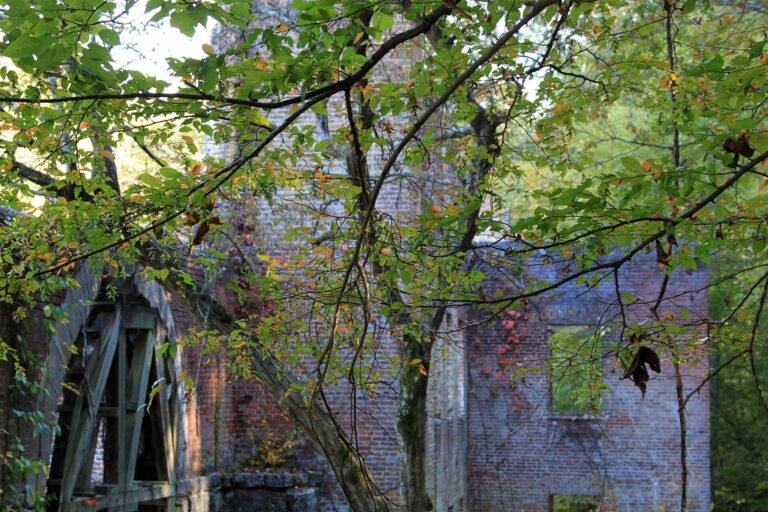
Sweetwater Creek’s Red Trail is the closest genuine hike-to-a-ruin experience to Atlanta — a 2-mile round trip on a wide gravel path to the burned-out five-story New Manchester Mill, an 1849 Confederate-era textile mill.
- Drive/Parking: About 25 min via I-20 W to Lithia Springs; $10 ParkPass per vehicle.
- Stroller: Partial — flat and wide for the first half-mile to the mill ruins overlook, then rockier the rest of the way to Sweetwater Falls.
- Dogs: Leashed, 6 feet max, per statewide Georgia State Parks rules.
- Restrooms: At the visitor center near the trailhead.
- Best time: Weekday mornings; this is one of the busiest state parks in metro Atlanta on weekends.
- Tip: Stay behind the fencing at the mill ruins — the structure is unstable and off-limits to climb.
11. Stone Mountain (Walk-Up and Cherokee Trails)
Stone Mountain gives you two very different hikes on the same granite monadnock: the steep 1-mile Walk-Up Trail straight up the exposed dome, or the gentler 5-mile Cherokee Trail loop around its base.
- Distance: Walk-Up Trail: 1 mile one-way (2 miles round trip), about 786 feet of elevation gain on exposed rock. Cherokee Trail: 5-mile loop on dirt tread, moderate.
- Drive/Parking: About 25 min via Stone Mountain Freeway (US-78 E). Stone Mountain Park is run by the Stone Mountain Memorial Association, not Georgia State Parks, and charges its own per-vehicle parking fee — check current parking rates before you go, since it’s separate from the $10 statewide ParkPass.
- Stroller: No on either trail — exposed rock on the Walk-Up, dirt tread with roots on Cherokee.
- Dogs: No dogs on the Walk-Up Trail; leashed dogs are allowed on the Cherokee Trail.
- Restrooms: At the trailhead plaza and several points around the base.
- Tip: The Walk-Up Trail has zero shade — carry more water than you think you need in summer. For the full park layout, see our Stone Mountain Park guide.

12. Kennesaw Mountain National Battlefield Park
Kennesaw Mountain packs Civil War history into a 2-mile round-trip summit hike, climbing roughly 700 feet in the first mile on a rocky, root-crossed path from the visitor center.
- Drive/Parking: About 30 min via I-75 N to Marietta; $5 daily entrance pass per vehicle, required at all 10 park lots, or $40 annually. America the Beautiful passes accepted.
- Stroller: No on the summit trail; the park’s paved Kennesaw Mountain Drive gives an easier, more gradual walk to the top for anyone skipping the rocky trail.
- Dogs: Leashed dogs (6 feet max) are allowed throughout the park, including the summit trail.
- Restrooms: At the visitor center.
- Best time: Weekday mornings; the summit trail is one of the most-used hiking trails in the entire National Park System.
- Tip: The park does not accept cash at fee machines — bring a credit or debit card.
What is the best hike in Southwest Georgia?
13. Providence Canyon State Park
Providence Canyon earned the nickname “Georgia’s Little Grand Canyon” from erosion that began with 1800s farming practices, and the white-blazed Canyon Loop Trail circles nine canyons in a 2.5-mile round trip.
- Distance: Canyon Loop Trail: 2.5 miles, easy to moderate. Backcountry Trail: a red-blazed, 7-mile loop rated extremely rugged, with primitive campsites for backpackers.
- Drive/Parking: About 2 hrs 45 min via I-85 S and US-27 S toward Lumpkin; $10 ParkPass per vehicle.
- Stroller: No — the loop trail descends into and out of sandy, exposed canyon floors.
- Dogs: Leashed, 6 feet max, per statewide park rules.
- Restrooms: At the visitor center near the trailhead.
- Tip: The canyon floor has no shade and gets hot fast — plan a morning start between April and October.
Where can you hike on the coast and in South Georgia?
14. Cumberland Island National Seashore
Cumberland Island is Georgia’s only genuinely wild barrier island hike — flat, sandy trails past feral horses and the Dungeness mansion ruins, reachable only by ferry or private boat.
- Distance: About 1 mile one-way from the Sea Camp dock to the Dungeness Ruins on flat sand and shell paths; longer routes reach 5+ miles toward Plum Orchard.
- Drive/Parking: About 5 hrs via I-75 S and I-95 S to St. Marys, where the National Park Service ferry departs.
- Cost: A $15 per-person, 7-day entrance pass (16 and older) plus a separate ferry ticket — about $44 round trip for adults, less for seniors and youth, free for kids 5 and under.
- Stroller: Not recommended — sandy, uneven paths and no paved surfaces.
- Dogs: Not allowed on the ferry (private boat only); leashed pets are permitted on the southern portion of the island but banned from the wilderness area covering most of the north half, and pet camping is not allowed.
- Restrooms: At the Sea Camp dock area only.
- Tip: Book the ferry well in advance — it has limited daily capacity and sells out during spring and fall weekends. Reserve at recreation.gov.
15. Okefenokee National Wildlife Refuge (Chesser Island Boardwalk)
The Chesser Island Boardwalk is the easiest way to see the Okefenokee Swamp on foot — a 1.5-mile round trip (0.75 mile each way) on an elevated boardwalk ending at a 40-foot observation tower over open “prairie” wetland.
- Drive/Parking: About 5 hrs via I-75 S and US-84/US-1 to the Suwannee Canal Recreation Area near Folkston; $5 per vehicle (7-day pass) or $15 annual refuge pass.
- Stroller: Yes — flat, wide boardwalk with railings the entire way.
- Dogs: Leashed dogs (6 feet max) are allowed on refuge roads and most trails, but not on the boardwalk itself.
- Restrooms: At the Suwannee Canal Recreation Area visitor contact station.
- Best time: Early morning or late afternoon for wildlife viewing, especially alligators and wading birds; bring insect repellent year-round.
- Tip: Combine it with a guided boat tour from the recreation area if you want to see more of the swamp than the boardwalk covers.
| Fee system | What it costs | Trails it covers | Notes |
|---|---|---|---|
| Georgia State Parks ParkPass | $10 per vehicle per day, or $70 annually | Tallulah Gorge, Amicalola Falls, Cloudland Canyon, Sweetwater Creek, Providence Canyon | Raised from $5 on January 1, 2026, the first increase in 16 years |
| Chattahoochee National Forest day-use | $4-$5 per vehicle | Raven Cliff Falls ($5), Dukes Creek Falls ($4) | The state ParkPass is not accepted at national forest trailheads |
| Brasstown Bald day-use | $10 per adult (16 and older); free for ages 15 and under | Brasstown Bald Summit Trail | Shuttle runs 10 a.m. to 5 p.m., last departure 4:30 p.m., none 12:30-1:10 p.m. |
| National Park Service entrance pass | $5 per vehicle per day, or $40 annually | Kennesaw Mountain National Battlefield Park | Required at all 10 park lots; America the Beautiful passes accepted; fee machines take cards only, no cash |
| Park pass plus ferry | $15 per person for a 7-day pass (16 and older), plus about $44 round trip for adults | Cumberland Island National Seashore | Less for seniors and youth, free for ages 5 and under; ferry sells out on spring and fall weekends |
| Refuge pass | $5 per vehicle for 7 days, or $15 annual refuge pass | Okefenokee National Wildlife Refuge (Chesser Island Boardwalk) | Separate from both the state ParkPass and NPS passes |
| Stone Mountain Park parking | Per-vehicle parking fee; check current rates | Walk-Up and Cherokee Trails | Run by the Stone Mountain Memorial Association, not Georgia State Parks, so the $10 ParkPass does not apply |
| Free trailheads | No fee | Blood Mountain via the Byron Reece Trail, Preacher’s Rock at Woody Gap | The Blood Mountain lot fills by mid-morning on fall weekends |
| Gorge floor permit | Free, but you still pay the $10 ParkPass to park | Tallulah Gorge Floor Trail | Capped at 100 people per day, not issued after 4 p.m. (3 p.m. during daylight saving time); closed-toe shoes required |
How should you plan a Georgia hiking trip?
Buy the $70 annual ParkPass if you plan to hit more than seven Georgia state park days this year — Tallulah Gorge, Amicalola Falls, Cloudland Canyon, Sweetwater Creek, and Providence Canyon all take the same pass, and it pays for itself quickly. National forest trailheads (Raven Cliff, Dukes Creek) and Kennesaw Mountain use separate fee systems, so a state ParkPass won’t cover them.
North Georgia mountain trails see their heaviest crowds on October weekends during fall color season and the first warm weekends of spring. Weekday mornings before 10 a.m. are consistently the quietest window across every trail on this list.
If you’re building a longer trip around these best hikes in Georgia, our North Georgia mountains road trip itinerary strings together several trailheads from this list with overnight stops. Traveling with kids and want shorter, flatter options closer to the city? See our easy hikes near Atlanta with kids guide.
For dog owners specifically, our dog-friendly hikes near Blue Ridge guide covers leash rules and water access in more depth, and our stroller-friendly waterfalls guide lists flatter alternatives to several trails above. For lesser-known options beyond this list, check our 12 hidden gem state parks in Georgia.
Which trail fits the day you actually have?
| If you… | Do this | Why |
|---|---|---|
| Only have a half day from Atlanta | Sweetwater Creek’s Red Trail, or the Cherokee Trail at Stone Mountain | Both are about 25 minutes out, the closest trailheads on this list; the Red Trail is a 2-mile round trip on mostly flat gravel |
| Want the shortest hike to the biggest view | Preacher’s Rock from Woody Gap | A 1.9-mile round trip with 440 feet of gain buys a 360-degree view of the Blood Mountain range, versus 4.3 miles and 1,400 feet for Blood Mountain itself |
| Have a stroller or a carrier | The Chesser Island Boardwalk, Cloudland Canyon’s Overlook Trail, or the West Ridge Falls Access trail at Amicalola Falls | These are the only genuinely flat options: 0.75 miles of railed boardwalk, a flat 1-mile loop, and a 0.3-mile recycled-tire trail loop |
| Are bringing the dog | Stick to the Tallulah rim trails, Sweetwater Creek, Cloudland Canyon, or the Cherokee Trail | Leashed dogs on a 6-foot maximum are fine there; the Gorge Floor Trail, Hurricane Falls Loop, Stone Mountain Walk-Up Trail, and Chesser Island Boardwalk ban dogs outright |
| Want the free option, no ParkPass | Blood Mountain via the Byron Reece Trail, or Preacher’s Rock at Woody Gap | Both have free trailhead lots, against $10 per vehicle at Georgia state parks since January 1, 2026 — but the Blood Mountain lot fills by mid-morning on fall weekends |
| Are hiking in summer heat | Dukes Creek Falls, and skip the Stone Mountain Walk-Up Trail and the Providence Canyon floor | Dukes Creek descends through a hemlock and mountain laurel ravine; the Walk-Up Trail has zero shade and the canyon floor has none either |
| Need to avoid a closure or a sold-out permit | Raven Cliff Falls or the Tallulah Gorge rim trails | Panther Creek has been fully closed since April 2025 for storm damage, and gorge floor permits are capped at 100 people a day — arrive by 9 a.m. on weekends |
Local legend: The Nunnehi of Blood Mountain
What is actually true: The Georgia Historical Society’s Blood Mountain marker tells this story and says one of the Nunnehi townhouses was said to stand near Lake Trahlyta. Blood Mountain rises to 4,458 feet in the Chattahoochee National Forest.
Tallulah Gorge floor permits, stairs and 2026 water-release dates are in our Tallulah Gorge State Park guide.
FAQ
What is the most beautiful hike in Georgia?
Tallulah Gorge and Cloudland Canyon are the two most dramatic hikes in the state, each offering canyon-rim views most people don’t expect from Georgia. Amicalola Falls and Raven Cliff Falls are the top picks if a waterfall is the main draw.
Do I need a permit for any hikes in Georgia?
Only one trail on this list requires a permit: the Tallulah Gorge Floor Trail, which needs a free same-day permit from the Interpretive Center and is capped at 100 hikers per day. Every other trail here is open without reservation, though Cumberland Island’s ferry should be booked in advance since seats are limited.
What is the easiest hike in Georgia with a big payoff?
The Chesser Island Boardwalk at Okefenokee National Wildlife Refuge is flat, stroller-friendly, and paved-equivalent for its entire 0.75-mile length, ending at a swamp observation tower. Closer to Atlanta, Sweetwater Creek’s Red Trail delivers mill ruins and rapids in a 2-mile round trip on mostly flat gravel.
How much does it cost to park at Georgia’s state parks in 2026?
Georgia State Parks raised the ParkPass fee to $10 per vehicle per day (or $70 annually) effective January 1, 2026, the first increase in 16 years. This applies at Tallulah Gorge, Amicalola Falls, Cloudland Canyon, Sweetwater Creek, and Providence Canyon. National forest trailheads and Stone Mountain Park charge separate fees that the state ParkPass does not cover.
Which of these hikes are dog-friendly?
Most trails on this list allow leashed dogs, but three specific sections do not: the Tallulah Gorge Floor Trail and Hurricane Falls Loop, the Stone Mountain Walk-Up Trail, and the Chesser Island Boardwalk at Okefenokee. National forest trails (Blood Mountain, Preacher’s Rock, Raven Cliff Falls, Dukes Creek Falls) technically only require voice or physical control rather than a leash, but a leash is safer given creek crossings and rocky terrain.
What’s the best time of year to hike in North Georgia?
Mid-October to early November brings the best fall color and the biggest crowds; late April through May brings wildflowers and mountain laurel with fewer people. Summer hiking is doable but plan for afternoon thunderstorms and start early to beat both heat and crowds.
Tallulah Gorge or Cloudland Canyon: which is the better day?
Tallulah Gorge is the easier trip if you are starting in Atlanta, at about 1 hour 50 minutes, and it packs five overlooks on each rim into roughly 3 miles plus an optional permitted gorge floor. Cloudland Canyon is 2 hours 20 minutes out and a full day, with a 5-mile West Rim Loop along 1,000-foot canyon walls and a flat 1-mile Overlook Trail for strollers.
Is the $70 annual ParkPass worth it versus paying daily?
It pays for itself if you will visit Georgia state parks more than seven days in a year, since the daily rate is $10 per vehicle. The same pass covers Tallulah Gorge, Amicalola Falls, Cloudland Canyon, Sweetwater Creek and Providence Canyon. It does not cover national forest trailheads, Kennesaw Mountain or Stone Mountain Park.
What should you hike if you only have a half day from Atlanta?
Sweetwater Creek’s Red Trail is the pick: about 25 minutes via I-20 W, a 2-mile round trip on wide gravel to the 1849 New Manchester Mill ruins, with restrooms at the visitor center and a $10 ParkPass to park. Stone Mountain’s Cherokee Trail is the same 25 minutes out if you want a 5-mile loop instead. Go on a weekday morning before 10 a.m.
Where should you go if Panther Creek is closed or gorge floor permits run out?
Raven Cliff Falls and the Tallulah Gorge rim trails are the closest open substitutes. Panther Creek Recreation Area has been fully closed since April 2025 for Hurricane Helene damage, possibly for two years. Raven Cliff runs roughly 5 miles round trip for $5 per vehicle; the rim trails total about 3 miles with five overlooks on each side.
How we checked this guide: Dates, hours, admission and parking prices, and access details were verified against the official sources listed below on . Operators change schedules and raise prices without notice, so confirm anything time-sensitive before you drive. The figures in this guide also feed our Georgia Attraction Transparency Index and Family Day-Out Cost Index.
Sources
- Georgia State Parks — ParkPass Fees
- Georgia State Parks — 2026 ParkPass Fee Increase FAQ
- Georgia State Parks — Park Rules & Pet Policy
- Georgia State Parks — Tallulah Gorge Trails & Gorge Floor Permits
- Georgia State Parks — Cloudland Canyon Trails
- Georgia State Parks — Providence Canyon Trails
- Georgia State Parks — Sweetwater Creek Trails
- U.S. Forest Service — Raven’s Cliff Wilderness Trailhead
- U.S. Forest Service — Dukes Creek Falls Recreation Area
- U.S. Forest Service — Panther Creek Recreation Area Closure Alert
- U.S. Forest Service — Panther Creek Recreation Area
- Brasstown Bald Visitor Center & Recreation Area — Fees & Hours
- Georgia Appalachian Trail Club — Approach Trail Mileage
- National Park Service — Kennesaw Mountain Fees & Passes
- National Park Service — Cumberland Island Fees & Passes
- National Park Service — Cumberland Island Pet Policy
- U.S. Fish & Wildlife Service — Okefenokee National Wildlife Refuge Visitor Info
- Stone Mountain Park — Parking Information

Hank Whitlock is the pen name of the It's Georgia editor. Every guide is built around the questions a busy family actually asks before a trip: how long is the drive, what does parking cost, can the stroller make it, are dogs allowed. Details are checked against official park, city, and venue sources, and each guide shows the date it was last updated.
More from Things to Do


Cite this page: It's Georgia, “15 Best Hikes in Georgia: The Ultimate Trail Guide (2026)”, itsgeorgia.com/things-to-do/outdoors-hiking/best-hikes-in-georgia/ (updated ). Free to quote with attribution and a link to this page.